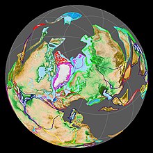
Eurasia (/jʊəˈreɪʒə/, also UK: /-ʃə/) is the largest continental area on Earth, comprising all of Europe and Asia.[3][4] According to some geographers, physiographically, Eurasia is a single continent.[4] The concepts of Europe and Asia as distinct continents date back to antiquity, but their borders are arbitrary and have historically been subject to change. Eurasia is connected to Africa at the Suez Canal, and the two are sometimes combined to describe the largest contiguous landmass on Earth, Afro-Eurasia.[5]
 | |
| Area | 55,000,000 km2 (21,000,000 sq mi) |
|---|---|
| Population | 5.4 billion (As of 2023)[1][2] |
| Population density | 93/km2 (240/sq mi) |
| Demonym | Eurasian |
| Countries | ~93 countries |
| Dependencies | 9 dependencies |
| Time zones | UTC−1 to UTC+12 |
https://en.wikipedia.org/wiki/Eurasia
Dependent territories
The following entities are territories in Eurasia that remain outside the controlling state's integral area.
| Flag | Map | English short name | English long name | Legal status | Domestic short name | Domestic long name | Capital |
|---|---|---|---|---|---|---|---|
| Akrotiri and Dhekelia | Sovereign Base Areas of Akrotiri and Dhekelia | British overseas territory | Akrotiri and Dhekelia | Sovereign Base Areas of Akrotiri and Dhekelia | Episkopi Cantonment | ||
| British Indian Ocean Territory | British Indian Ocean Territory | British overseas territory | British Indian Ocean Territory | British Indian Ocean Territory | Diego Garcia | ||
| Christmas Island[n 8] | Territory of Christmas Island | External territory of Australia | Christmas Island | Territory of Christmas Island | Flying Fish Cove | ||
| Cocos (Keeling) Islands[n 8] | Territory of Cocos (Keeling) Islands | External territory of Australia | Cocos (Keeling) Islands | Territory of Cocos (Keeling) Islands | West Island | ||
| Faroe Islands |
|
Constituent country of the Kingdom of Denmark | Faroese: Føroyar Danish: Færøerne |
|
Tórshavn Faroese: Tórshavn Danish: Thorshavn | ||
| Gibraltar |
|
British overseas territory | Gibraltar |
|
Gibraltar | ||
| Guernsey[n 7] | Bailiwick of Guernsey | Crown dependency of The Crown in Right of Guernsey | English: Guernsey Guernésiais: Guernesey |
English: Bailiwick of Guernsey Guernésiais: Bailliage de Guernesey |
Saint Peter Port Guernésiais: Saint-Pierre Port | ||
| Isle of Man[n 7] |
|
Crown dependency of The Crown in Right of the Isle of Man | English: Mann Manx: Mannin |
English: Isle of Man Manx: Ellan Vannin |
Douglas Manx: Doolish | ||
| Jersey[n 7] | Bailiwick of Jersey | Crown dependency of The Crown in Right of Jersey | English: Jersey Jèrriais: Jèrri |
English: Bailiwick of Jersey Jèrriais: Bailliage de Jersey |
Saint Helier Jèrriais: Saint-Hélyi |
Special areas of internal sovereignty
The following entities are an integral part of their controlling state but have a political arrangement which was decided by an agreement with another state.
| Flag | Map | English short name | English long name | Legal status | Domestic short name | Domestic long name | Capital |
|---|---|---|---|---|---|---|---|
| Åland | Åland Region | Autonomous region of Finland | Swedish: Åland Finnish: Ahvenanmaa |
Swedish: Landskapet Åland Finnish: Ahvenanmaan maakunta |
Mariehamn Swedish: Mariehamn Finnish: Maarianhamina | ||
| Hong Kong | Hong Kong Special Administrative Region | Special administrative region of China | Chinese: 香港 |
Chinese: 香港特别行政區 |
Admiralty Chinese: 金鐘 | ||
| Jan Mayen | Jan Mayen | Territory of Norway administered by the county governor of Nordland with some authority delegated to the station commander of the Norwegian Defence Logistics Organisation, a branch of the Norwegian Armed Forces.[7] |
Norwegian: Jan Mayen | Norwegian: Jan Mayen | Olonkinbyen Norwegian: Olonkinbyen | ||
| Macau | Macau Special Administrative Region | Special administrative region of China | Chinese: 澳門 Àomén |
Chinese: 澳門特別行政區 Àomén Tèbié Xíngzhèngqū |
Nam Van Chinese: 南灣 | ||
| Svalbard | Svalbard | Special territory of Norway | Norwegian: Svalbard | Norwegian: Svalbard | Longyearbyen Norwegian: Longyearbyen |
See also
https://en.wikipedia.org/wiki/List_of_sovereign_states_and_dependent_territories_in_Eurasia#Dependent_territories
 Laurasia (centre) and Gondwana (bottom) as part of Pangaea 200 Mya (Early Jurassic) | |
| Historical continent | |
|---|---|
| Formed | 1,071 Mya (Proto-Laurasia) 253 Mya |
| Type | Supercontinent |
| Today part of |
|
| Smaller continents | |
| Tectonic plate | |
Laurasia (/lɔːˈreɪʒə, -ʃiə/)[1] was the more northern of two large landmasses that formed part of the Pangaea supercontinent from around 335 to 175 million years ago (Mya), the other being Gondwana. It separated from Gondwana 215 to 175 Mya (beginning in the late Triassic period) during the breakup of Pangaea, drifting farther north after the split and finally broke apart with the opening of the North Atlantic Ocean c. 56 Mya. The name is a portmanteau of Laurentia and Asia.[2]
Laurentia, Avalonia, Baltica, and a series of smaller terranes, collided in the Caledonian orogeny c. 400 Ma to form Laurussia (also known as Euramerica, or the Old Red Sandstone Continent). Laurussia then collided with Gondwana to form Pangaea. Kazakhstania and Siberia were then added to Pangaea 290–300 Ma to form Laurasia. Laurasia finally became an independent continental mass when Pangaea broke up into Gondwana and Laurasia.[3]
https://en.wikipedia.org/wiki/Laurasia


No comments:
Post a Comment